Operations

High Fidelity Digital Twin

Live Data

Smart Spatial Operation Image

Our assets exist in three dimensions – why settle for flat, outdated interfaces to manage them?

3D & 4D UI’s provide context and spatial awareness, amplifying the value from traditional systems and unlocking new opportunities for efficiency and savings.

Immersive User Experiences once exclusive to large infrastructure projects due to the high costs, are now accessible thanks to advancements in GPU, AI and software interoperability.

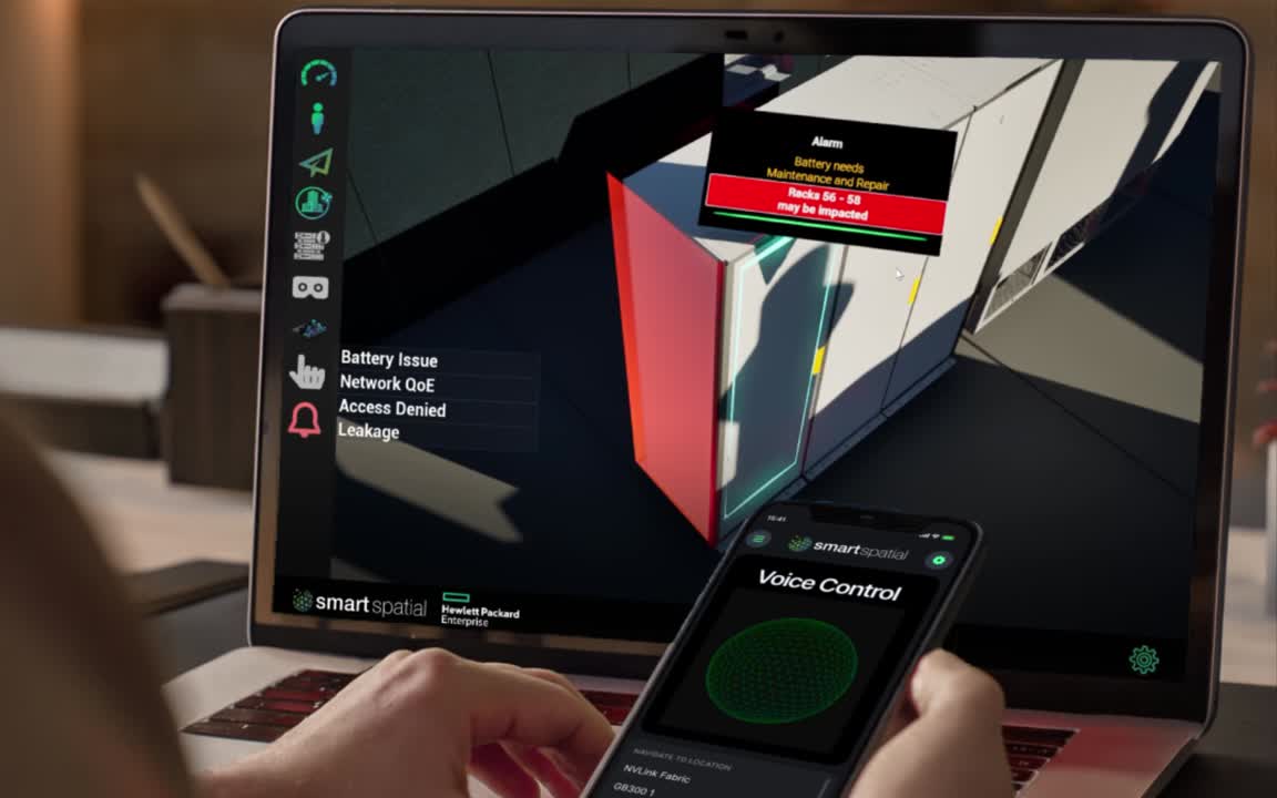
Smart Spatial's operational digital twin delivers life-like, immersive visualization combined with live data, deployable in weeks. This creates a single source of truth and a unified user experience for seamless operations.

One 3D view instead of dozens of 2D screens

Single Source of Truth

Live data ingestion

Integrate any systems and sensors

X-Ray vision: see in a twin what you cannot see in physical world

Time machine - replay past events

See how systems interoperate

2-way communication with control capability

Geospatial Alarming

Operations features

Supervision

(Monitoring & Control)

One 3D view instead of dozens of 2D screens
Single Source of Truth
Live data ingestion
Integrate any systems and sensors
X-Ray vision: see in a twin what you cannot see in physical world
Time machine - replay past events
See how systems interoperate
2-way communication with control capability
Geospatial Alarming
Operations features

Maintenance and Repairs

3D Location of any asset
Integrated Manuals and Logs
X-Ray vision to explore assets before repairs
Component-Level Detail
Create and approve tickets in 3D
Analytical Heat maps
Historical records
Operations features

Collaboration

Share files and notes in 3D
Request feedback
Create and approve tickets in 3D
Talk to your assets
Setup notifications
Virtual visits for remote workers and contractors
Space booking / Reservation
Operations features

Training

Lifelike training simulation
X-Ray vision
Spatial Awareness
Data Ingestion methods
Data source types
Vendors

How We Work

01.

BIM to Twin

Creating the Core Assets & Environment
Duration: 1-2 Weeks

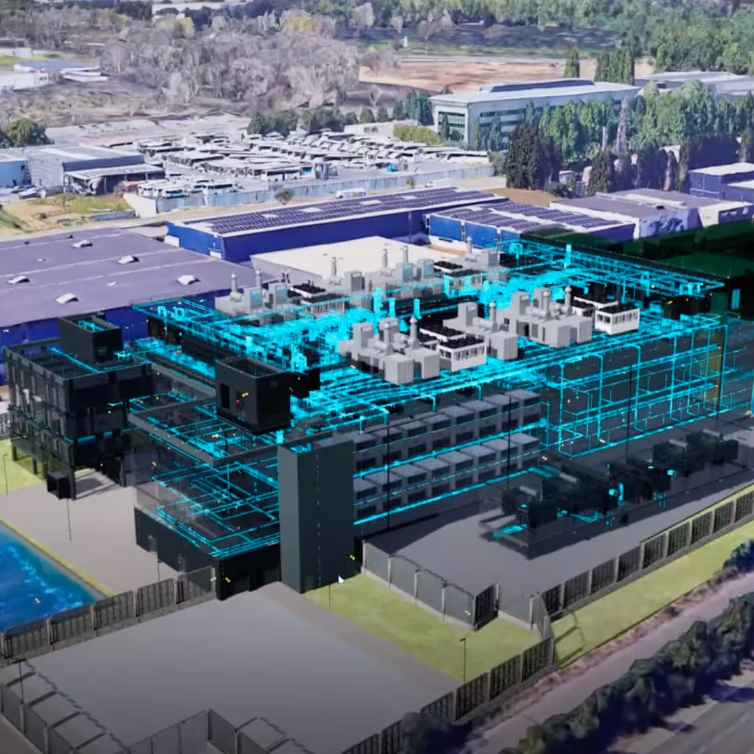
In this phase, Smart Spatial Team ingests the BIM Model (REVIT, IFC etc.)  of a site and/or equipment, and creates a digital replica of the asset with high fidelity 3D materials. 
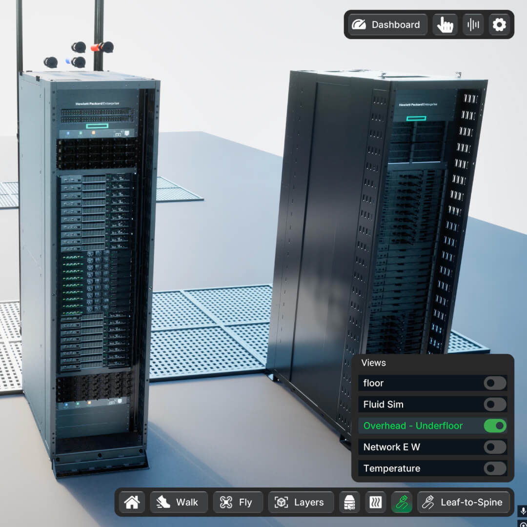
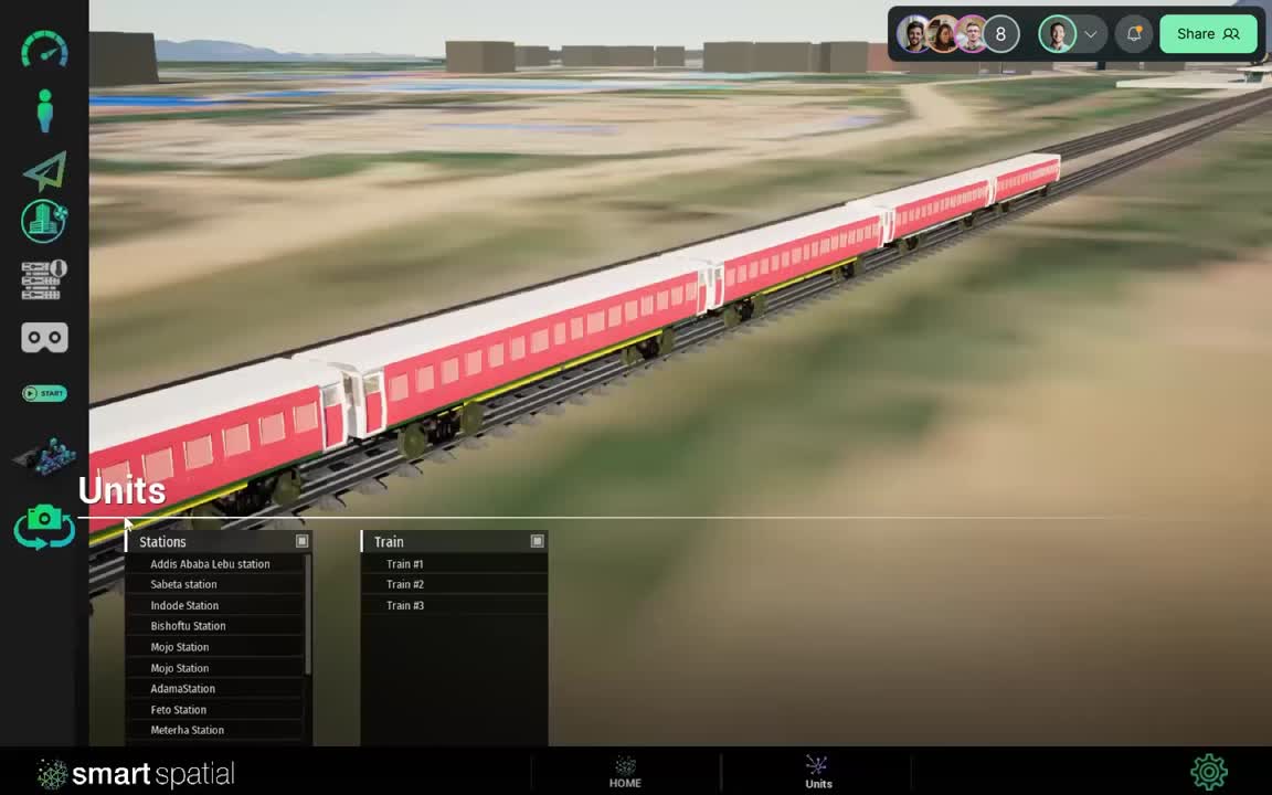
The asset is placed in a digital world accessible across desktop, mobile and VR with fully interactive navigation such as Fly mode, Walk mode, and one-click navigation to any pre-set views.

Benefits:

The Model is immediately accessible to Sales and Marketing staff to facilitate Virtual Tours, enable true-to life demos, and produce still and video collateral for campaigns. The interactive model can be showcased at trade-shows and events. The model is also useful to the Operations team in reducing on-site vendor visits by facilitating a digital site walk-through, and remote collaboration.

02.

Data Ingestion

Operationalizing the Digital Twin
Duration: 1-3 Months

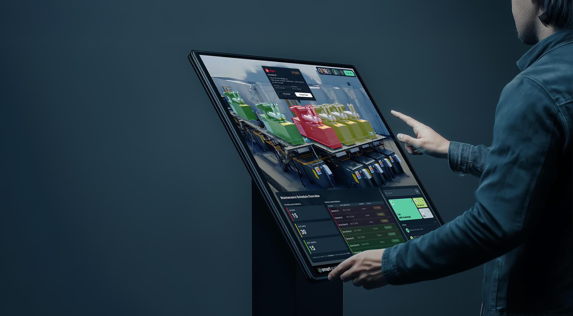
In this phase, we identify and integrate the key telemetry and operational systems into the twin environment. Systems can include: BMS, EMS, CMMS, DCIM, FDD/Analytics, Access Control etc.

Benefits:
A synchronized digital twin with data driven geometry enhances operational activities and provides a single source of truth/single pane of glass for multiple operational systems.

The instant availability and multi-device accessibility enables operational excellence on site and in remote (NOC) setting.
The Spatial awareness improves new employee training and ongoing equipment maintenance.

03.

Use Case Applications

Driving Value with Custom Workflows
Duration: Per Scope

In this phase, the team is free to choose various use cases to implement in the virtual environment to extend its usefulness across various business functions. Use cases may include:
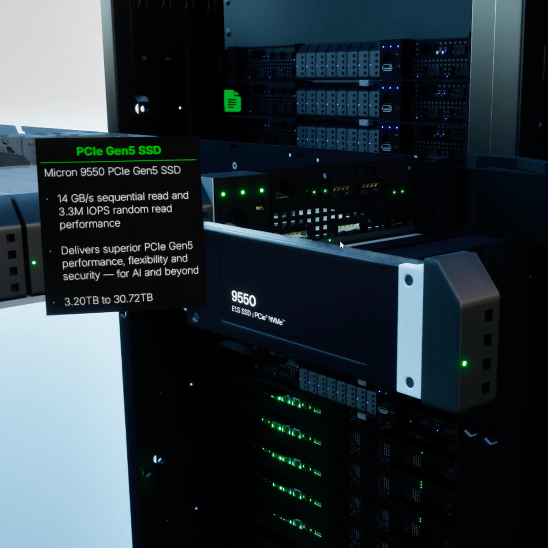
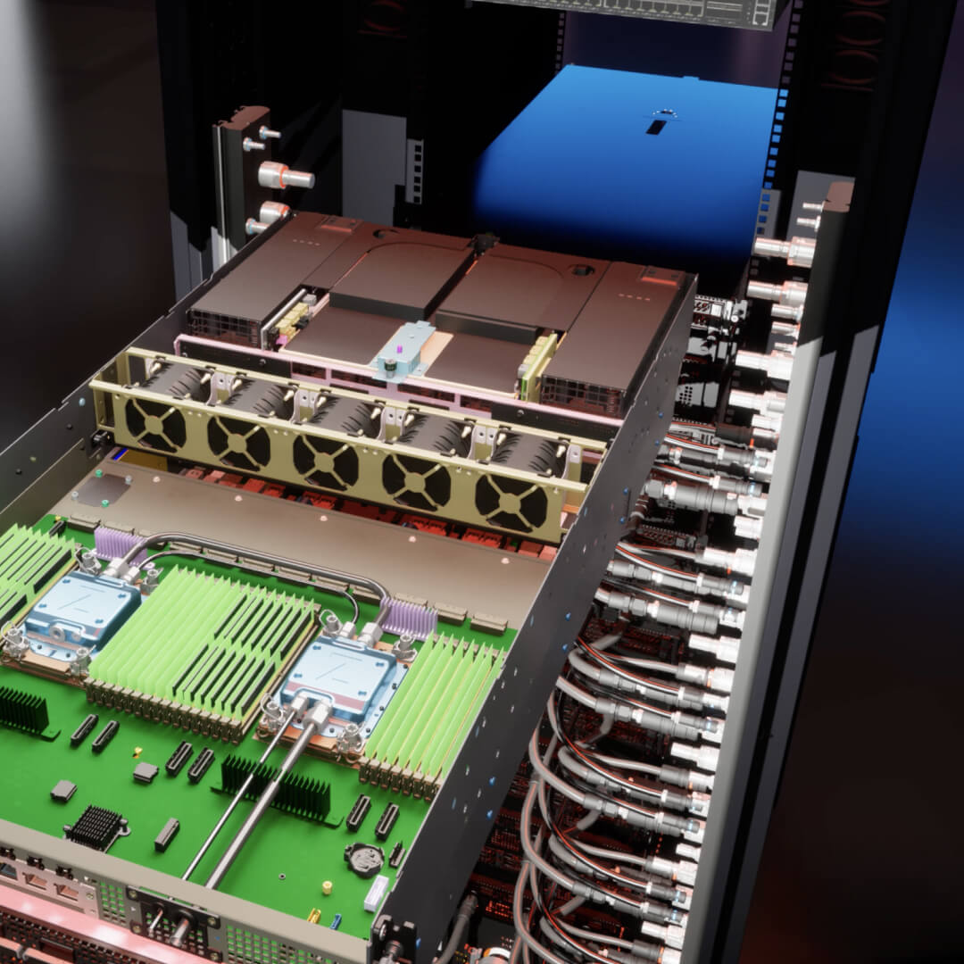
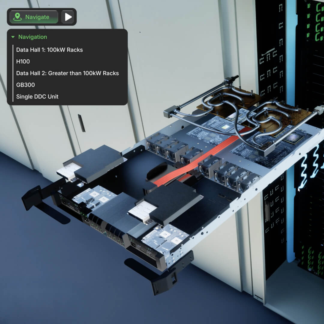
Expanding the model to extreme equipment detail down to the nuts and bolts, drastically improving maintenance efficiency.

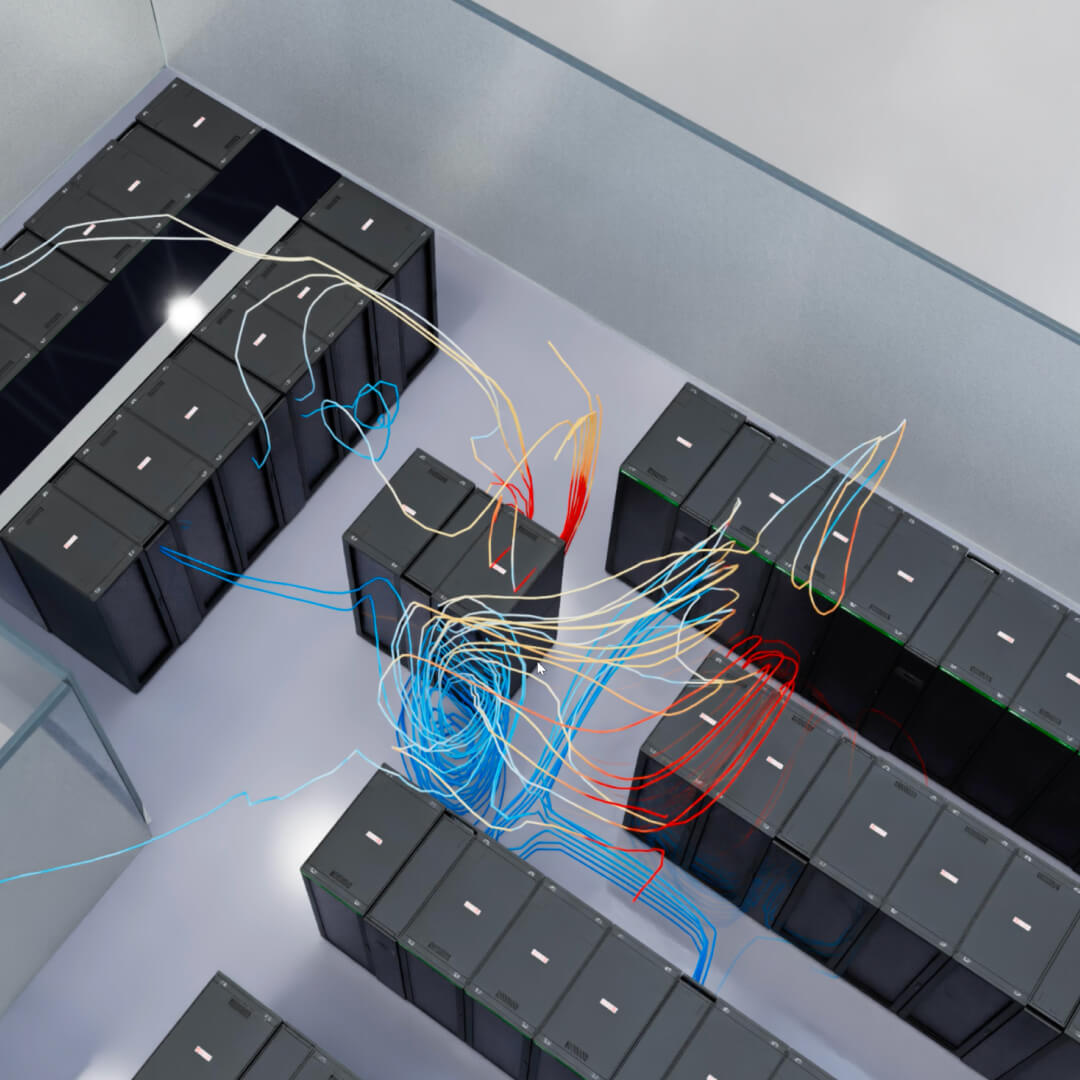
Adding Flow & Fluid physics enables the model to show air, liquid, and power flows.

Adding custom Training scenarios and walk-throughs.

Adding Simulation to show what-if scenarios, with a “DVR” type capability to go back and forward in time.

Adding 1-click custom views such as show all cable trays, show networking, show all firebreak walls, etc.

Benefits:
With the fundamentals done: (Model and Data), the environment can be infinitely and rapidly enhanced to tackle very specific and unique use cases with minimal effort.

Success Stories

See how businesses are leveraging Smart Spatial to create innovative, efficient, and sustainable building solutions — faster than ever

Kevlinx is transforming client engagement with their BRU01 Digital Twin in Brussels. Powered by Smart Spatial’s platform, it provides high-fidelity visualization of the facility, even during construction, speeding time-to-market. Clients gain real-time access to vital sustainability metrics like PUE, WUE, and CUE, making reporting simpler, transparent, and efficient.

Schedule
a product demo

Schedule a call
Schedule a call
Smart Spatial X-ray View Image
By clicking “Accept All Cookies”, you agree to the storing of cookies on your device to enhance site navigation, analyze site usage, and assist in our marketing efforts. View our Privacy Policy for more information.